Buying on Kiawah Island means being close to water, which is part of the magic and part of the due diligence. You want a clear read on flood zones, elevation, and insurance before you write an offer or finalize a design. In this guide, you’ll learn how to read FEMA maps, what local elevation rules mean, how Risk Rating 2.0 affects premiums, and the steps that protect your purchase. Let’s dive in.
Why flood zones matter on Kiawah
Flood zones help you understand where a property sits relative to the 1 percent annual chance flood, also called the base flood. Lenders and insurers use these zones to set requirements, and local building rules tie elevation to the map. When you speak the language of zones and elevation, you can price risk, plan improvements, and avoid surprises at closing.
How to read FEMA maps
What a FIRM shows
A FEMA Flood Insurance Rate Map, or FIRM, outlines Special Flood Hazard Areas, labels risk zones like AE or VE, and shows Base Flood Elevations (BFEs) where available. Start every property review by pulling the official panel and the Flood Insurance Study from the FEMA Map Service Center. You can search any address and download a FIRMette for your records at the FEMA Map Service Center.
- Use the FEMA Map Service Center to pull your panel: FEMA MSC address search
Key zone definitions
- AE: Detailed study area with a published BFE inside the 1 percent annual chance floodplain.
- VE: Coastal high‑hazard zone with wave action where pile foundations and breakaway walls are standard.
- AO/AH: Shallow flooding or ponding zones with depth numbers.
- X: Areas outside the mapped 1 percent annual chance floodplain.
These designations guide both lender requirements and minimum construction rules.
Map changes and letters
Maps are updated over time. When a boundary is off or a structure is higher than the map suggests, FEMA’s Letters of Map Change can correct it. If a property sits near a boundary, a survey and Elevation Certificate can be a smart early step. You can review LOMA and LOMR submittal paths on FEMA’s Online LOMC portal: FEMA Online LOMC help.
Kiawah’s current map and elevations
Most homes in Zone AE
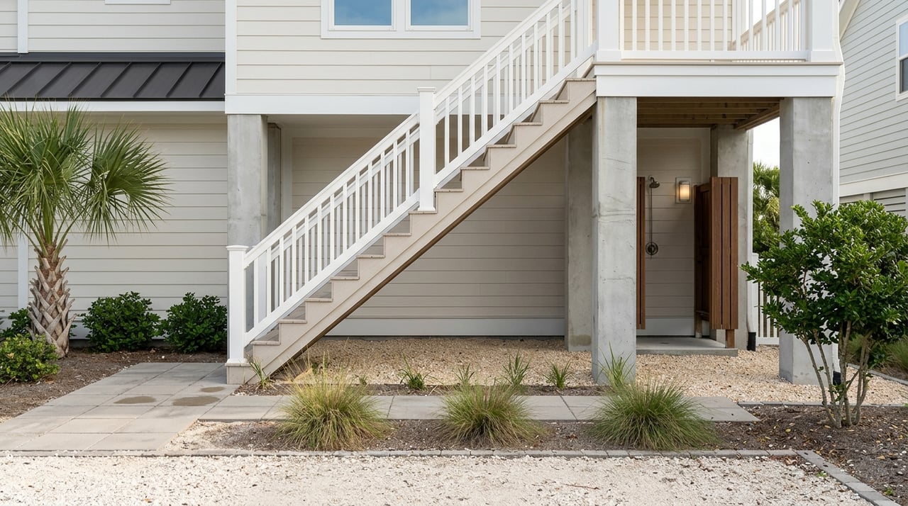
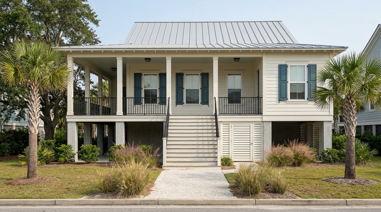
Local guidance for Kiawah reports that the majority of residential parcels are mapped in Zone AE, with portions of some properties in VE. BFEs vary by neighborhood and even by a few feet within the island. Many newer homes are elevated on pilings with open parking or storage below living areas, built to meet BFE plus local freeboard. See the Kiawah Community Association’s building scenarios overview: KICA residence scenarios.
2021 FIRM updates you should note
Charleston County’s updated FIRMs became effective for the area around January 29, 2021. Town materials discuss the effective date and BFE changes that followed. Always record the effective FIRM date for the parcel under contract, since changes can influence design heights, insurance requirements, and lender conditions. Review the Town Council packet summary: Town of Kiawah Council materials.
Town vs. County freeboard rules
Jurisdiction matters on Kiawah. Town guidance references a 1‑foot freeboard standard for certain town-regulated properties, while Charleston County’s floodplain ordinance sets a Design Flood Elevation equal to BFE plus two feet of freeboard for parcels under county rules. Confirm which permitting authority applies to your lot before you set design elevations or assume allowable ground‑level use. For the county standard, see the ordinance: Charleston County Flood Ordinance. For town guidance and island patterns, see KICA’s overview above.
Elevation certificates and map changes
When an Elevation Certificate helps
A FEMA Elevation Certificate documents surveyed elevations for the building’s lowest floor, machinery and equipment, and adjacent grade, tied to the FIRM’s vertical datum. Under the NFIP, accurate elevation data helps rate policies correctly, supports compliance with local rules, and strengthens decisions about mitigation. The certificate is completed by a licensed surveyor, engineer, or architect. Get the current form here: FEMA Elevation Certificate form.
How a LOMA can change requirements
If a structure is shown in a Special Flood Hazard Area but sits above the mapped BFE, a Letter of Map Amendment can remove the mandatory purchase requirement for that building. The process typically requires an Elevation Certificate and other documentation, submitted through FEMA’s Online LOMC portal. Details and instructions are available at FEMA Online LOMC help.
Insurance basics on Kiawah
NFIP and Risk Rating 2.0
FEMA’s Risk Rating 2.0 prices most NFIP policies using property‑specific factors like replacement cost, first‑floor elevation, distance to water, foundation type, occupancy, and prior claims. Zone still matters for lender rules and construction, but two homes in the same zone can see very different premiums under RR2.0. When you shop, provide your replacement‑cost estimate and elevation data for the most accurate quote. Learn more in FEMA’s overview: Risk Rating 2.0 summary.
Coverage limits and common gaps
Standard NFIP residential limits are up to $250,000 for the building and $100,000 for contents, with a limited Increased Cost of Compliance benefit for eligible compliance expenses. Many higher‑value coastal homes add private excess coverage to bridge the gap between NFIP limits and full rebuilding cost. Review program details in the NFIP Manual: NFIP Flood Insurance Manual.
Private and excess flood options
Private flood insurers often offer higher limits and added features such as loss of use, though underwriting, deductibles, and nonrenewal practices vary by carrier. Expect a standard 30‑day waiting period on new NFIP policies. Private carriers may have different waiting periods and terms, so plan ahead.
CRS discounts to check
FEMA’s Community Rating System provides community‑level premium discounts for flood‑mitigation work and public information. Charleston County and the Town of Kiawah Island participate in CRS. Discount percentages can change over time, so confirm the current class for the jurisdiction that applies to your parcel when you obtain quotes.
Features that influence risk and cost
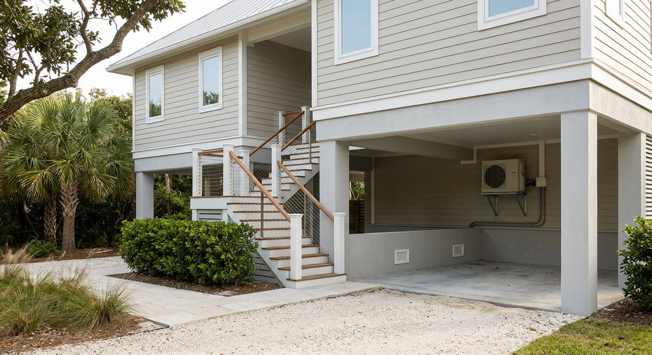
Foundation and lowest floor
On Kiawah, many newer homes are pile‑elevated with open space below the living area. In VE zones, the elevation of the lowest horizontal structural member relative to BFE is a key measure. Documenting this elevation with an Elevation Certificate can support rating and compliance.
Mechanicals, enclosures, and materials
Elevate HVAC units, water heaters, and electrical panels above the design flood elevation to reduce damage potential and support favorable underwriting. If there is an enclosure below the living space, ensure it follows flood‑resistant construction standards with proper openings and materials. These details matter for building approvals and claims.
Island mitigation and drainage
Kiawah has invested in drainage and targeted flood‑mitigation projects to improve roadway passability and neighborhood drainage after storms. When evaluating a home, note nearby projects and how they affect access and livability. See a recent project update: KICA mitigation projects.
Buyer checklist
Use this step‑by‑step list to keep your due diligence on track.
- Pull the effective FIRM panel and Flood Insurance Study for the address, and note the effective date. Start at the FEMA Map Service Center.
- Check the Charleston County flood viewer for local overlays and tools: County flood viewer.
- Ask for any existing Elevation Certificate and any prior Letters of Map Change. If none exist and the structure is near a boundary or a lender requires coverage, budget for a survey and EC. Use the current FEMA form: Elevation Certificate.
- Confirm jurisdiction and freeboard. Determine whether Town of Kiawah or Charleston County rules apply. County DFE equals BFE plus two feet. Review the town’s 2021 materials here: Town Council packet and the county ordinance here: Charleston County Flood Ordinance.
- Obtain an NFIP quote and at least two private flood quotes. Provide the building’s replacement‑cost estimate and elevation data so RR2.0 pricing reflects the actual structure. See FEMA’s RR2.0 overview: Risk Rating 2.0.
- For condos or villas, review the association’s master flood policy, wind policy, limits, and deductibles. The NFIP offers a Residential Condominium Building Association Policy with specific limits. Details are in the NFIP Manual.
- If a survey indicates the structure may be above the mapped BFE, consider a LOMA to change the map designation and loan requirements. See application paths at FEMA Online LOMC help.
- Document nearby community drainage or mitigation projects that may affect access and storm recovery. Reference island updates here: KICA mitigation projects.
The bottom line
On Kiawah Island, flood zones, elevation, and insurance all connect. Start with the FIRM, confirm your BFE and jurisdiction, gather accurate elevation data, and price both NFIP and private coverage using the home’s true replacement cost. With the right information, you can choose confidently, design smartly, and protect your investment.
If you want a calm, experienced guide for this process, reach out to Russ Knapp to talk through your goals and next steps. Schedule a Free Consultation.
FAQs
What do FEMA flood zones mean for a Kiawah home purchase?
- FEMA zones label the level of flood risk and drive lender requirements and minimum building standards, so you should confirm the property’s zone and BFE on the FEMA MSC before you make decisions.
How can an Elevation Certificate affect my premium on Kiawah?
- An Elevation Certificate documents first‑floor and equipment elevations, which NFIP uses under Risk Rating 2.0 to price coverage more accurately, potentially lowering costs when the surveyed elevation is favorable.
What changed with the 2021 FEMA maps covering Kiawah Island?
- Charleston County’s updated FIRMs became effective around January 29, 2021, which adjusted BFEs in some areas and can influence building height rules and insurance requirements, so note the effective date for your parcel.
Do flood zones still matter under FEMA’s Risk Rating 2.0?
- Yes, zones still guide lender rules and construction, but RR2.0 also prices policies using property‑specific factors like elevation, distance to water, and replacement cost, so two nearby homes can get different premiums.
What are typical NFIP coverage limits for Kiawah buyers?
- Standard NFIP residential limits are up to $250,000 for the building and $100,000 for contents, so many higher‑value homes add private excess flood coverage to reach full rebuilding cost.
How do Town of Kiawah and Charleston County elevation rules differ?
- Town guidance references a 1‑foot freeboard in certain cases, while Charleston County’s ordinance uses BFE plus two feet as the Design Flood Elevation, so confirm which authority regulates your parcel.